About the Bay
Merrymeeting Bay is a complicated collection of systems, all working together to make the Bay function as a whole. Look here to start to find out how it all works...
Engineering
How the Bay Works
- What is Merrymeeting Bay?
- Not a Bay since it is not on the ocean
- Not a true Estuary as its average overall water salinity does not exceed .5 parts per thousand
- "Tidal Riverine" - from Augusta Dam to outlet of Merrymeeting Bay (US Fish & Wildlife Service)
- Large, "inland, freshwater river delta". Merrymeeting Bay is 17 miles from the ocean. It has the broad, fanlike areas of sediment that characterize river deltas.
- The Watershed
- The six contributing rivers constitute a watershed = 9524 sq miles
- Kennebec ('Long Quiet Water') drains 5,893 sq miles (1/5 Maine's land mass)
- Androscoggin ('Place for Curing Fish') drains 3524 sq miles
- Cathance ( Cat'-hance) (Traditionally this name was said to mean 'crooked' but more likely it means 'main or principal branch.') drains 70 sq. miles; 20 mi long; Rises in swamp in Bowdoin +-1.5 miles east Litchfield line. Flows through Topsham, Bowdoin, Bowdoinham; average tidal flow 5'5 " First bridged +-1820 (1805?) private toll bridge Shingleman's Creek (B'ham Adv.7/78)(B'ham Adv. Vol II. #1)
- Eastern 50 sq miles Dresden and Pittston
- Abbagadasett ('Little Parallel River') 20 sq miles Bowdoinham
- Muddy rises in Topsham
- The Tides - 5 foot rise and fall of tide; 10,000 acres fresh water tidal flats
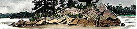
The Chops are a narrow, 600 yard wide, cleft at the point where water flows out of Merrymeeting Bay and into the lower Kennebec on its way to the ocean. Carved out by a glacier 10,000 years ago, it was called 'Kebec' or 'Spot that Seems Closed' by the Indians. All the Bay waters (from 6 rivers draining +-2/5 of Maine) have to flow through the Chops. Every 12 hours the ocean tide comes into the Lower Kennebec and holds back water flowing out through the Chops. Fresh water flowing down, slows and actually is forced back upstream, raising the water level in the Bay +- 5 feet. This tidal influence is felt all the way to Augusta. Little salt water penetrates into the Bay itself.
"The Chops, at the outlet of Merrymeeting Bay, is a drowned waterfall. Our best guess, based on the rate of coastal emergence, is that it was drowned about 5000 years ago. Before that time the Chops would have been a massive waterfall..." Kennebec River Resource Management Plan: Maine State Planning Office, 1993
|
|